Taylor Yards Park
![]()

Envisioned
to serve as “the crown jewel” of the 2007 Los Angeles river Masterplan and
serve as a catalytic project for other river-related projects.


The City of Los Angeles, Department of Public Works, Bureau of Engineering (BOE) is building near-term, interim uses and planning for future, long-term uses, on the recently purchased G2 parcel for a future Taylor Yard River Park. The AECOM/Tetra Tech team seeks to support the City in this exciting and important undertaking. Eighty years ago, Taylor Yard was a thriving hub of railroad-related industry. It served as one of the central nodes for freight movements in and out of the manufacturing heart of Los Angeles with a workforce of 5,000 people. While railyard activities have ceased, traces of that rail history are still evident on the site. Prior to railyard use and river channelization, the site was occupied and surrounded by lush riparian wetlands and an unusually abundant amphibian population. This was primarily due to the river’s meandering nature in this location as shown by historic photos of the Taylor Yard area. And reflecting the potential for restoration of this site, the last documented Steelhead trout was caught in the Glendale Narrows in the 1940s.The proposal realizes opportunities such as: serving the community, connecting across the river, and restoring the riparian corridor.
Community-serving Connected Park.
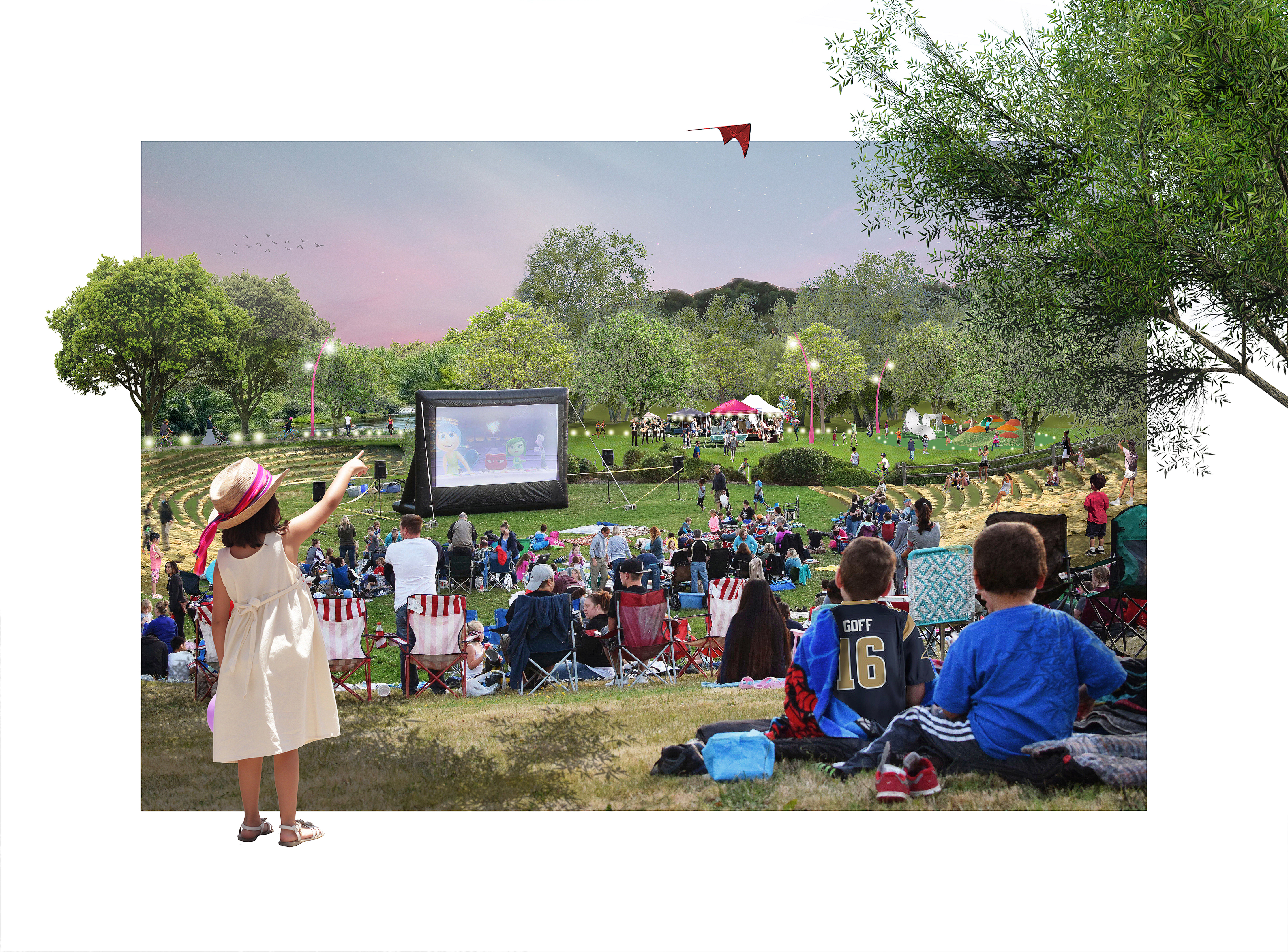
In addition to offering the greatest potential for demonstrating
river restoration within the City, the G2 site offers a unique opportunity to
build catalytic community recreation and open space project connecting into the
growing number of river-oriented parks and open spaces provided along the LA
River corridor. The site offers opportunities to connect with the Rio de Los Angeles
State Park immediately to the northeast of the G2. The future G2 park can serve
both local community needs and as a catalyst for further regional river corridor
development.
Connecting Across the River.

Access via the proposed pedestrian bridge crossing from the western
river bank to the southwestern residential neighborhoods will be critical to providing
easier access to the site. The design for the park should take this into
account as a major gateway and iconic element for the park. Our team
understands the interface between the site, river hydraulics and the flow paths
affecting – and affected by – the location of the bridge.
Riparian Corridor Restoration.

Using all of the substantial analysis and planning work for the site over the past 30 years, a world class restoration strategy will be developed for the G2 site to: re-establish riparian and adjacent upland terrace habitat/bio-diversity; enhance habitat connectivity providing regional benefits; utilize an innovative and visionary approach to restoring riparian hydrology, while maintaining flood control; establish/restore ecosystem services, including carbon sequestration, microclimate control, rainwater capture and air quality improvements.